Geographical Simulation and Optimization System (GeoSOS)
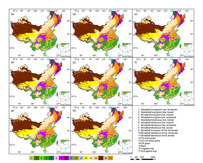
High-resolution land use products are crucial for climate models to forecast the impacts of land use changes and assess mitigation effectiveness at regional and local scales. Although the new global land use projections, i.e., LUH2 product, are produced to serve for CMIP6 and IPCC AR 6, its spatial resolution is still too coarse for various regional climate studies. Therefore, the aim of this study is to generate a set of high-resolution projections of land use changes for regional researches in China with the new integrated scenarios of SSPs-RCPs. First of all, land use projections require to be clear about land use response to multiple global and regional measures not only in quantity but also in geospatial variations. Here we extract the trajectories of land use demand for different land use types in eight SSP-RCP scenarios in China from the existing LUH2 datasets, and then conduct high-resolution land use simulations (1 km) for the period of 2015-2100 in 5-year interval using the newly developed FLUS model. On this basis, to make up for the gap between the outputs of land use projections with greater spatial resolution and the inputs of the format requirements with multiple plant functional types (PFTs) for ESMs, the land use simulation results are further reclassified according to the PFT classification. As a result, a 1-km resolution product, which can provide finer spatial details for the changes of six kinds of land use types (i.e., forest, grassland, barren, cropland, urban, and water) for 2015-2100 with eight SSP-RCP scenarios in China, has been produced. Furthermore, a corresponding 5-km resolution product, which provides the fractions of multiple PFTs for each grid cell, has also been prepared for use in the CLM model.
The format of all files in this dataset is ".tif". In the PFT product, the value of a grid means the proportion of a certain land type. The total proportion of all land types in a grid is 100%.
The data of land use projections over China based on the plant functional type (PFT) classification from 2015 to 2100 in eight SSP-RCP scenarios are available to download in: Here
The data of the 6-type land use projections over China from 2015 to 2100 in eight SSP-RCP scenarios are available to download in: Here
Please cite this article as: W. Liao, X. Liu, X. Xu, G. Chen, X. Liang, H. Zhang, X. Li, Projections of land use changes under the plant functional type classification in different SSP-RCP scenarios in China, Science Bulletin (2020), doi: https://doi.org/10.1016/j.scib.2020.07.014.
Last updated: 19 July, 2020